Orthomosaic Maps show greater detail than Google Earth maps

Automated flight course of drone for mapping mission

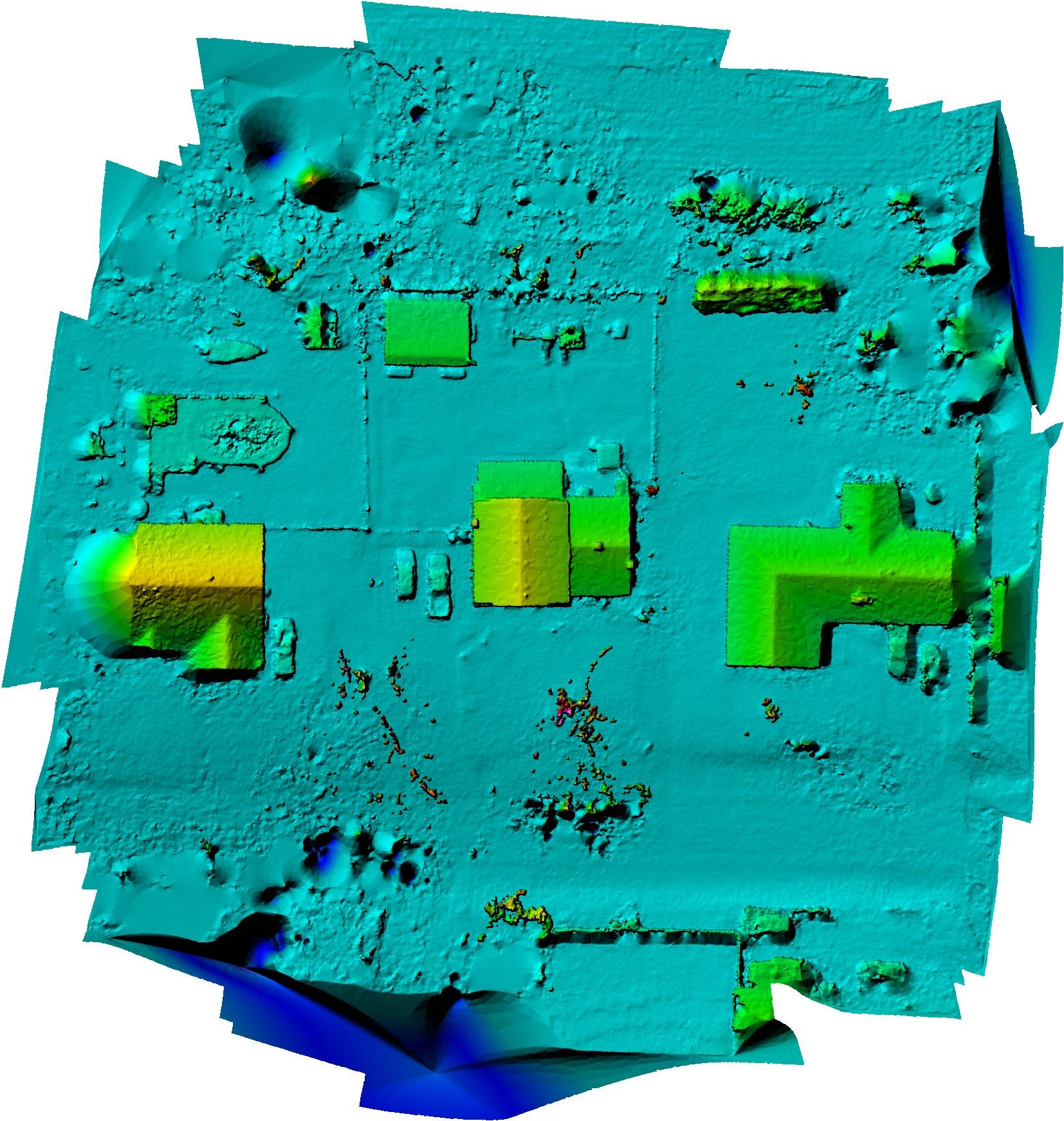
Colorized DEM: Digital Elevation Model
An orthomosaic map is like Google Earth, but more detailed. It is a large, map-quality image with high detail and resolution made by combining lots of images called orthophotos.
An orthoimage, is an aerial photo that has been corrected for lens distortion, camera tilt, perspective, and topographic relief, which is changes in the elevation of the earth’s surface. These corrected orthophotos have no distortion and a uniform scale across the image.
The key difference between a normal aerial photo and an orthophoto is the perspective and accuracy. A normal aerial photo, has a perspective view. You can see the sides of buildings and other objects, and the perspective changes depending on where the photo was taken.
An orthophoto, on the other hand, is what is called “orthorectified”. It is geometrically corrected for this perspective view, along with lens distortion and camera angle, to create a perfectly straight-down view of all objects in the frame as you would see on Google Earth.
The precision and accuracy of orthophotos means both orthophotos and orthomosaics have the same quality as maps and can be used to measure true distances.
Orthomosaic maps have GPS data embedded in 100’s of photos used to stitch them together to make a detailed map that is correct within inches. Common use in several sectors:
Residential and Commercial Realtors use an othomosaic map to have an updated aerial view of a large piece of land
Construction firms need accurate measurements to measure area, distance and volume, calculate materials cost and utilize 3D models. Orthomosaics are great for performing aerial inspections of equipment and other facilities. They can be used for inspecting rooftops, solar installations, buildings that are falling apart, and more.
Agriculture Industry uses the collected data from multispectral cameras that recognizes specific bands of light, such as Red, Green, Blue, Red Edge, and Near-Infrared. This generates orthomosaic maps in a color form that allows farmers to get a detailed understanding of their vegetation health with an NDVI index. Farmers use them for inspecting the number of crops, the health of the crops, and any problem areas of the land.
In conclusion, orthomosaic maps can be used in court cases that require updated and accurate imagery of a property in question. They can be used to count trees, monitor forest health, count cattle, determine the number of cars in a parking lot, see the supplies on a construction site, measure rooftops, make annotations, compare an area by date for a progress report and so much more.

